Posts filed under ‘Otisco Lake Park’
Otisco Lake Cycle — WOW!
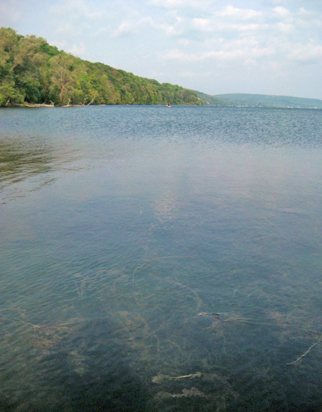
View looking forth from the Causeway on the west side
A sweet little 20 mile ride around Otisco Lake is not long enough to make my seat sore — but the vertical on the west side of the lake will destroy any quads you thought you had.

Where else where you see a lunar lander but Otisco!
Park on the east side of the lake at the Lakeside Park (free but only about 6 spots!) and head clockwise so you can enjoy the winding, picturesque Otisco Valley Road that goes right up next to the water and rides pretty flat from North to South.

Beautiful barn at sunrise
View at the southern end of the lake as you cross the flats to the western side.
Make the turn at the southern end of the lake and enjoy rolling fields of grass. Ride along the lakeside (113) up to the point of the causeway and take a break and walk out onto the causeway and enjoy the view.
Once you hop back on your bike you have an enormous climb up Stanton Rd (246) straight up the side of what feels like a mountain. You continue to climb up all the way to Route 41. Once on 41, you get beautiful glimpse of Skaneateles Lake as you race downhill towards Borodino.
It was a very windy day. This was the first time I worried that the combination of gusts and downhill speed would blow me off my bike. I think I was traveling about 40+ mph and felt myself veering into the ditch.
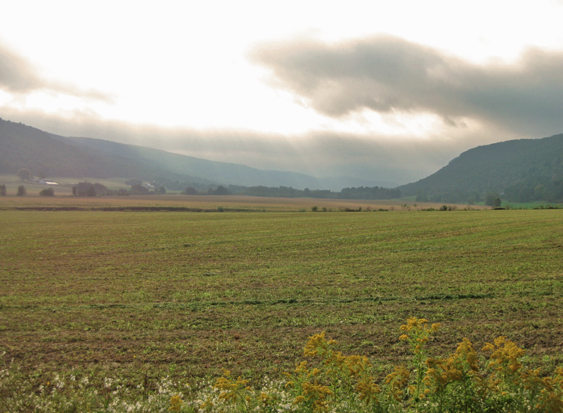
 Once you hit Borodino you turn right and head back to Otisco on Rt 174. You’ll pass by some very pretty barns and farm land as you head back towards the north end of the lake.
The view as you return to the northern end and ride down the very long hill.
There is a wonderful quick video of a bike race that goes around Otisco. It gives you a quick look challenging and charming this ride is.
Otisco: Mysterious Lake

Otisco view north from the Causeway
On a cold sunny day I took off to explore the eastern-most Finger Lake, Otisco, which I have always found to be unique and mysterious.
The first mystery for me was it’s origin.
“Otisco” is Iroquois for “Waters Dried Away,” Originally it was small, marshy area. A dam was constructed on the northern end at Nine Mile Creek in 1869, which raised the water level by 9 feet, for use by the Erie Canal. Once more in 1908 it was damned, raising it another 4 feet for use by the City of Syracuse for water supply. (see “A” mark on the map). At it’s deepest point the lake is 60 feet deep, 6 miles long and 1 mile wide.

Otisco Lake Park

Cool Willows in Otisco Lake Park
I went looking for the locations where a non-resident could gain access to the lake. Otisco Lake Park was my first stop. The park has 600 ft of shoreline and some of the most stunning willows I have ever seen. There are restrooms and hand launch boating. The park is located at 2525 Otisco Valley Road in the town of Marietta (“C” on the map).
As I traveled further south on the County Rd 124/Otisco Valley Road, I enjoyed spectacular lake views — first from above and further south — right at lakeside.
I was headed for the next point of interest and my second mystery, The Otisco Lake Causeway (see “B”). This is a man-made barrier of rocks that spans the entire lake at its southern end. It was originally built for use by wagons to traverse the lake rather than circumvent. The mystery to me is why it still remains now that it is not a road for transport. It seems to serve no purpose other than a great fishing and photo spot. It seems very odd to have this unusual landmark remain without improving it for fisherman and hikers.

View of both sides of the lake from the Causeway
Accessing the causeway from the east side was a bit rough, as it was blocked by a large fallen tree. The pathway cross was not much of a path, but a very rocky and uneven surface, not friendly to hikers. Perhaps I should have tried accessing the Causeway from the west side of the lake. The view afforded by being out in the middle of the lake is wonderful. It was hard to capture on film the wonder of seeing both the north and south end of the lake in one view, separated by just a thin spit of land. (If you click on an image, it will open up full-size in a new window)

Otisco view of the south end of the lake -"The Shallows"
The lake below the causeway is quieter and calmer, referred to as “The Shallows.” (see “E”). A gap in the causeway close to the west bank allows for boats to travel through, and for the continuous passage of water into the southern which would otherwise be a marsh.. The result is a mixing of the silt of the marshland once there and the lake’s waters, gives the water south of the causeway a higher turbidity and a contrasting color (E on the map).

View north from the east side of the lake, halfway down
The pictures show how pretty this lake is, but it is not as accessible to visitors as the other Finger Lakes. There are few retail establishments — another mystery. I stopped at a gas station/general store on the eastern side, in the town of Amber. The lake, despite lots of camps and its obvious beauty, has not seen the heavy commercial development of lakes like Skaneateles or Canandaigua or even Conesus — which is similar to it in size.
If you want great fishing, privacy and quiet, this might be your lake. Walleye, tiger muskellunge, sunfish, perch, rock bass, crappie, both large and small mouth bass, white bass, bullhead, and brown trout are found in it’s waters. Plus, on the first day of bass season, usually around the end of the second week in June, the lake fills with boats for the annual fishing derby. There is no state boat launch and access for powerboats has to take place at the Marina
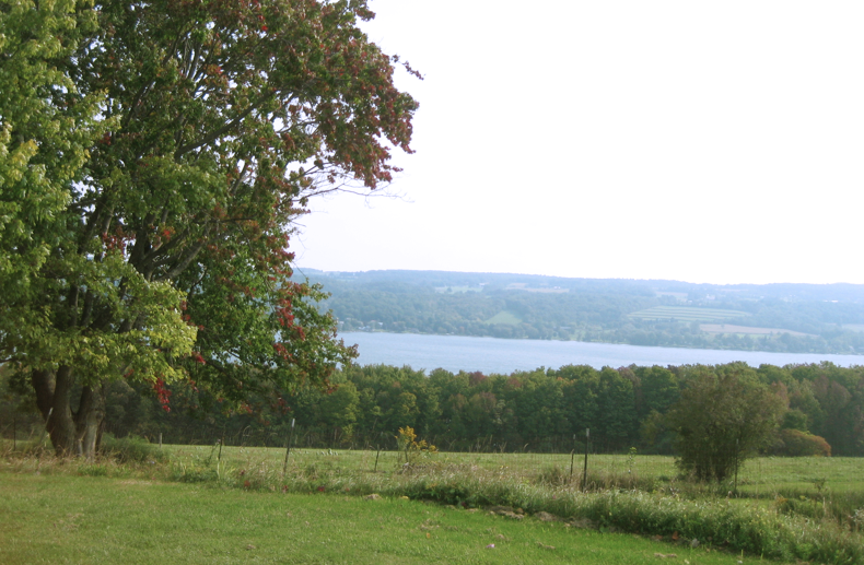
Bonus: If you travel the East Lake Road between Skaneateles and Otisco, you can catch a great view of both lakes.
![]()
